Landlords, legends, census records, and lost taverns.
St Stephen Coleman index
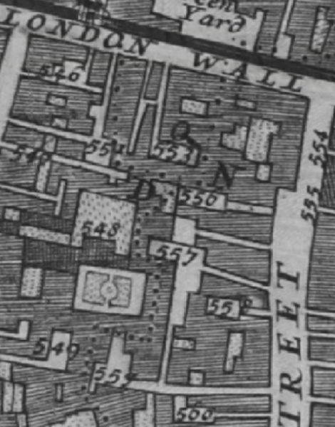
The 1682 Morgans Map of London shows the London Wall marked clearly, and Coleman street running south. Listed are 553 Fox & Goose Inne ; 555 Bell Inne ; 558 White hart Inne ; 559 White horse Inne and 560 Crown Inne.
Historical London public houses, Taverns, Inns, Beer Houses and Hotels.
Residents at this address.
In the 1682 Morgans Map of London it is denoted as '555 Bell Inne'.
In 1708 : A New View of London by Edward Hatton, the Bell Inn is on the East side of Coleman street, near the North end.
In John Strype Survey of London in 1720, listed as '39 Bell Inn' in the Coleman Street Ward and Bassishaw Ward map.
The 1746 Rocques Map of London, Westminster and Southwark clearly marks the same Bell Inn.